
By Simon Smith
So here we are in the middle of December as of this writing on December 13, 2018. So far the autumn season has been pleasant with a mix of sunshine and periods of wet weather but not much in the way of cold which has made some people very happy and some not so happy. After another hot summer, September came and brought much relief from the hot summer with temperatures ending up cooler than average for the month across all of Lincoln County. October started off on a cool note but ended up on the warm side of the column. November continued to be mild. December up until now has continued the mild and relatively dry trend. What will the upcoming winter season bring? I will try to answer that here in this article.
There is much discussion going on about the Climate Prediction Center’s (CPC for short) winter outlook which is calling for a weak El Nino to continue to develop across the Pacific and how that may affect the weather across the continent. While El Nino is a significant factor in the weather patterns across North America, it is only one factor of many that can contribute to how our winter will shape up. In any case I keep hearing people say that we are going to have a warm and dry winter because of El Nino or that’s what they heard on TV. Much of those conclusions are coming from an incorrect reading of the Climate Prediction Center’s or CPC for short, winter outlook.
What the CPC is saying is that the probability of above average temperatures for the months of December through February is between 50% to 60% with equal chances of above average, average or below average precipitation for the same time period for our region in Northwest Montana. These forecasts were made on November 15, 2018. In simple terms for the precipitation, the CPC is saying that they really don’t know how precipitation will go this winter. It also indicates that we may not necessarily have a dry or wet or even a “normal” winter as all are possible. To narrow it down for Lincoln County I decided earlier this autumn to look back at the years that had similar numbers during the summer and fall heading into winter and the winters that followed to make the prediction for our region. Here is what I found.
In a normal winter in Lincoln County, using historical records for Libby as a source, the average high temperature for the months of December, January and February is 35.3 fahrenheit with the average low being 21.6 fahrenheit. The average precipitation for the same period is 5.23 inches of precipitation which is a combination of rain and melted snow. Unfortunately there are no historical snowfall records for our region available. Looking back at two winters that closely resembled where we are right now, the winter of 1958-1959 and more recently the winter of 2014-2015 brought very different results. The 58-59 winter being a colder and snowier winter and the 14-15 winter being a very mild and dry winter. Where we are currently and where we appear to be headed resembles more closely that of the 14-15 winter.
One of the main factors that seems to greatly affect our region is the Pacific North America Pattern or PNA for short. Looking back at history for the two winters I have referenced notes that the PNA pattern went from weakly positive in November and December to weakly negative in January and February for 1958-1959 while for the same time period in 2014-2015 the PNA remained in the weakly positive phase but a little bit more so in the positive phase for that winter verses the same period in 58-59. There is a correlation between the positive phase of the PNA pattern and El Nino along with a corresponding negative phase of the PNA pattern and La Nina which is the opposite of El Nino. At this point in time the odds favor a positive phase of the PNA pattern throughout the upcoming 2018-2019 winter.
In addition to El Nino or La Nina and the PNA pattern, one other aspect I like to look at is North American snow cover which so accurately predicted the last 2 winters around here. From the charts I looked at most of the snow cover across North America currently, specifically in Canada is located across the eastern part of the region. This in part explains why the pattern across the continent for the end of October into November so far has been cold and stormy in the east and mild and relatively dry in the west, a result of a positive phase of the PNA pattern. Hudson Bay is beginning to show signs freezing over. If it does and the pattern continues to favor continued below average temperatures and snowfall across eastern Canada with upper level ridging across western Canada and the US that may end up locking us into the positive phase of the PNA for the winter with the weak El Nino helping to maintain that pattern. If on the other hand, the pattern flips, then the opposite is possible. The take away point here is that wherever the snow cover sets up across the continent early in the season often will determine where the Hudson Bay low or polar vortex sets up which largely governs the weather patterns across our region.
So what does all this mean for our region and what does it mean for our winter outlook? From the research that I have been able to do the winter outlook for 2018-2019 for our region looks something in-between the 1958-1959 winter and the 2014-2015 winter. In other words I believe that we will see a decent start to the winter later in December with some snowfall and near average temperatures that will likely persist into the beginning of January. Beyond that, it appears to me that our region may dry out and ridge up with the jet stream splitting with the southern or subtropical branch shifting more to our south into California and the northern or polar branch shifting well to our north into Northern British Columbia leaving our region dry and mild. Overall I tend to agree with the CPC that odds favor a milder than average winter and a near normal to slightly drier than normal winter. I do not think that our region will see the amounts of snowfall that have been common around here the past 2 winters but some significant snowfalls are possible. I would not be surprised to see some significant cold air outbreaks particularly if a strong positive phase of the PNA develops. Those cold air outbreaks are more likely to occur later into January or February. Towards the end of the winter season in late February or March we may see some wetter weather in our region but that is only a guess at this point. So in summary for Lincoln County I expect populated areas in the lower elevations to see near to slightly above average temperatures for the winter and near to slightly below average precipitation for our region. Will I be correct? Time will tell.
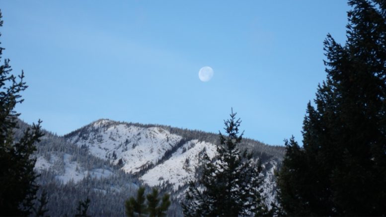
A photo of the moon over our beautiful Cabinet Mountains. Photo by Brian Baxter, The Montanian